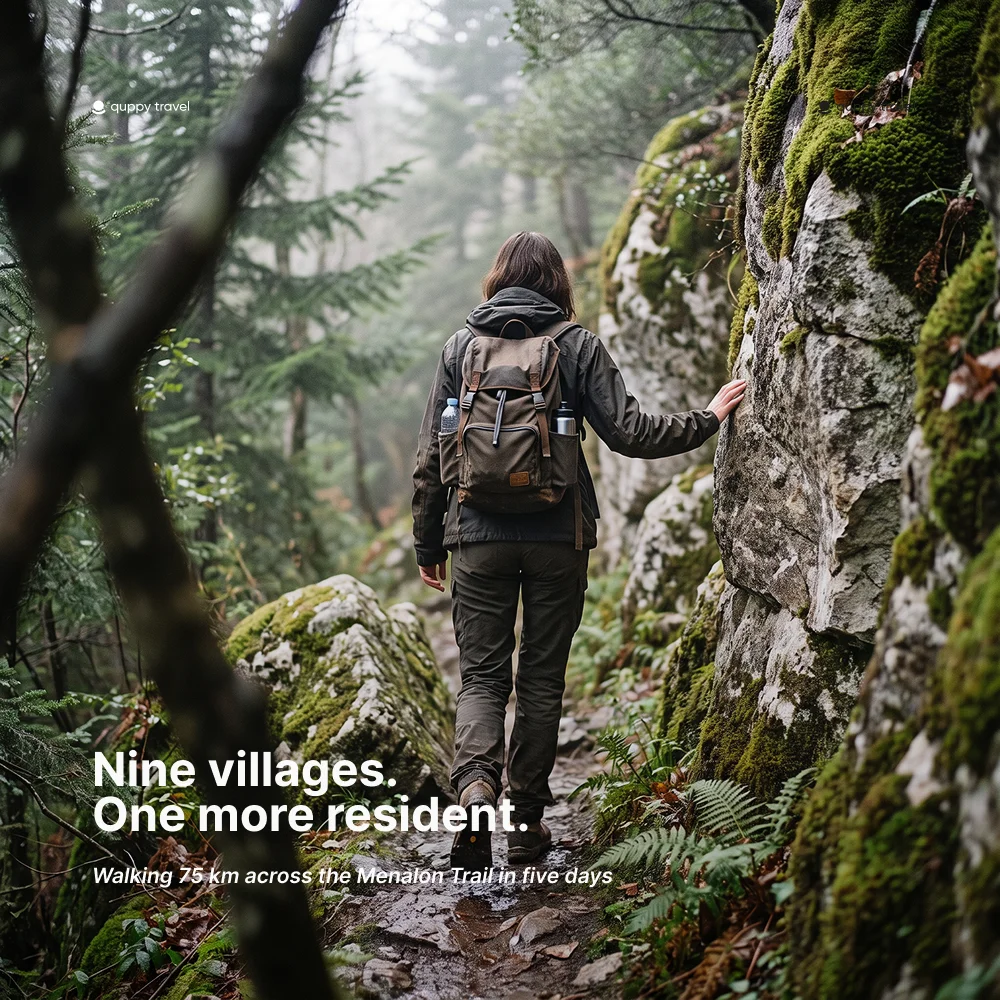
Nine villages, and one of them stopped shrinking.
The Menalon Trail is a 75 km waymarked hiking route across Arcadia in the central Peloponnese. It runs from Stemnitsa to Lagkadia in eight official sections, connecting nine mountain villages. Most walkers allow four to six days. I walked it in five, and the number I remember most is not 75. It is one.
Magouliana recorded 117 residents in the 2011 census and 118 in 2021. One more person is not a revival, and a walking trail cannot be credited with producing it. But after decades of watching the figures fall, the line on the page finally stopped pointing down. On a route created in part to keep visitors and services moving through Gortynia, that small interruption felt worth following.
Menalon Trail quick facts
- Route: Stemnitsa to Lagkadia, Arcadia, Greece
- Distance: 75 km across eight official sections
- Villages: Stemnitsa, Dimitsana, Zygovisti, Elati, Vytina, Nymphasia, Magouliana, Valtesiniko and Lagkadia
- Typical duration: four to six days; five days is a comfortable first itinerary
- Difficulty: moderate overall, with long climbs, rocky ground and two stages close to 15 km
- Best time: spring and autumn, when temperatures are generally kinder for exposed climbs
- Navigation: the trail is waymarked, but carry the current official map or offline route and check conditions before setting out
The eight Menalon Trail sections
The official route is divided into eight sections. You do not need to walk one section per day: shorter neighbouring stages can be combined, while the first and third deserve more space. The published times below are estimates, not promises. Stops, weather, luggage and comfort on steep ground can change the day substantially.
|
Section |
Route |
Distance |
Official time |
|
1 |
Stemnitsa → Dimitsana |
12.5 km |
5 hr |
|
2 |
Dimitsana → Zygovisti |
4.2 km |
2 hr |
|
3 |
Zygovisti → Elati |
14.9 km |
5 hr |
|
4 |
Elati → Vytina |
8.5 km |
2.5 hr |
|
5 |
Vytina → Nymphasia |
5.6 km |
2 hr |
|
6 |
Nymphasia → Magouliana |
8.9 km |
3.5 hr |
|
7 |
Magouliana → Valtesiniko |
6.6 km |
2.5 hr |
|
8 |
Valtesiniko → Lagkadia |
13.9 km |
5 hr |
How many days do you need for the Menalon Trail
Four days is possible for strong hikers prepared to combine stages. Six gives more time in the villages. Five sat between those versions for me: roughly 15 km on the longer days, with enough daylight left to buy food, wash socks and hear the particular silence that arrives after the last café chair has been stacked.
The route passes through nine villages, but a five-day plan does not mean sleeping in all nine. Some are natural overnight bases; others are lunch stops or places you pass between rooms. Accommodation is limited in the smaller settlements, so confirm opening dates and transfers before fixing the itinerary, especially outside the busiest walking months.
The linear shape also matters. Stemnitsa and Lagkadia are not the same place, and public transport is not frequent enough to improvise around. Plan the journey to the start and the onward trip from the finish before you arrive in Arcadia. Local taxis and accommodation providers often help with transfers, but that arrangement belongs in the plan, not in a hopeful final afternoon.
How difficult is the Menalon Trail
The Menalon Trail is a mountain walk rather than a technical climb. The difficulty comes from accumulation: repeated ascent and descent, loose or uneven stone, narrow sections, heat, and the weight of several consecutive days. Sections 1 and 3 are the longest official stages at 12.5 km and 14.9 km. Section 8 is almost 14 km and saves a final serious day for the approach to Lagkadia.
A reasonably fit walker with broken-in footwear and experience on rough paths should find the full route manageable. A beginner can still do it, but should train on hills, keep the pack light and resist turning every published time into a target. Rain changes limestone and mud quickly. Summer heat changes the body even faster.
Spring and autumn are the usual choices. April to June brings greener slopes and flowers; September and October trade some of that softness for warmer stone and harvest weather. Winter can bring snow at altitude, while high summer can make exposed climbing punishing. In every season, check the forecast, water availability and current trail notices rather than treating the calendar as a guarantee.
Lousios Gorge: the first section from Stemnitsa to Dimitsana
The first official section is 12.5 km and takes about five hours, not the short warm-up its position on the map may suggest. From Stemnitsa the trail drops toward the Lousios Gorge, crosses old paths and climbs again to Dimitsana. It is graded among the harder sections of the route.
The monasteries alter the scale of the gorge. The Monastery of Saint John the Baptist, or Prodromou, appears fastened to the cliff, its balconies projecting above the river. A local heritage account dates its small katholikon, the central church, to 1167. That is more precise than saying the entire monastery was founded in that year; mountain institutions tend to accumulate buildings, repairs and stories across centuries.
I had expected the religious sites to feel like interruptions in a hiking day. They did the opposite. The path, the water and the buildings belonged to the same problem: how to live in terrain that offers protection by making everything difficult. By the time Dimitsana appeared, I had stopped separating landscape from infrastructure.
The industries behind the Arcadian villages
These villages were not built as picturesque pauses for hikers. Dimitsana’s water-powered mills produced gunpowder and supplied the Greek War of Independence. Theodoros Kolokotronis later wrote that they had gunpowder because Dimitsana made it. The Open-Air Water Power Museum now explains the machinery, but on the trail the more useful evidence is the water itself: channelled, diverted and put to work.
Stemnitsa became known for metalwork and silversmithing. Lagkadia supplied generations of celebrated stone builders, people whose skill travelled farther than the village population eventually did. The route links settlements that once had distinct productive reasons to exist. Tourism is not replacing a blank past. It is arriving after workshops, mills and trades have lost the economic weight that held more families in place.
The trail was developed to strengthen tourism and local services in Gortynia and is maintained by the Menalon Social Enterprise. In 2015 it became the first route in Greece to receive the European Ramblers’ Association’s Leading Quality Trails certification. That label describes the path. Its more interesting test is what happens on either side of it.
What happened to the population of Arcadia
Arcadia had 77,592 residents in the 2021 census. The regional unit had roughly 87,000 a decade earlier, a decline of about 11%, while Greece as a whole fell by 3.1%. Regional figures blur the sharper changes in mountain settlements, where a closed shop or the loss of a bus can matter as much as the percentage itself.
Lagkadia makes the scale visible. Its recorded village population fell from 3,333 in 1949 to 1,188 in 1981, 671 in 1991 and 355 in 2011. Those years are not perfectly comparable measures of daily life, and a census cannot tell you who returns for weekends or summer. It can tell you that the permanent base became much smaller.
Walking can romanticise that process. An empty house looks beautiful for the length of a photograph. A village without enough year-round customers for a grocer is a different fact. The Menalon Trail brings beds, meals, taxis, maps and reasons to keep doors open. It does not automatically bring schools, medical care or permanent work. Both sentences can be true.
Magouliana: the village that gained one resident
Magouliana sits at about 1,365 metres, the highest village on the route. Historical population tables trace a long contraction: 2,342 residents in 1851, 844 in 1940, 471 in 1961, 319 in 1971, 238 in 2001 and 117 in 2011. The 2021 count was 118.
One person over ten years is statistically fragile. It may reflect a move, a return, a household decision or nothing that the trail influenced. I am not offering it as proof that hiking reverses depopulation. I am offering it because trends acquire an authority they do not deserve. After enough decades, decline begins to sound like a natural property of a place, like altitude or winter.
Then the next number is 118.
I stopped for coffee and tried to imagine which person the difference belonged to. That was the wrong question, of course. Census totals do not supply a protagonist. The useful story was that the line had moved in another direction at all, however slightly, and that somebody still had to unlock the café for a walker who had arrived carrying five days of other people’s villages in her legs.
The final walk into Lagkadia
The last section from Valtesiniko to Lagkadia is 13.9 km. Lagkadia appears in layers on a steep slope, stone houses stacked above and below the road. It is a fitting finish because the village refuses the easy visual grammar of arrival. There is no flat square waiting at the end of the path, only more levels, alleys and proof of what its builders knew.
Five days earlier I thought I was walking between nine settlements. By Lagkadia it felt more accurate to say I had been walking through nine arguments about what keeps a place inhabited: water, work, roads, family, faith, tourism, memory, a café, one resident. A certified trail can connect those things. It cannot settle the argument.
That is why I remember the one. Not because it rescues the story, but because it refuses to let the story close neatly.
Menalon Trail questions answered
How long is the Menalon Trail
The official Menalon Trail is 75 km long. It runs from Stemnitsa to Lagkadia through eight sections and nine villages in Arcadia.
How many days do you need for the Menalon Trail
Most hikers should allow four to six days. Five days balances the two long stages with time for Lousios Gorge, village meals and unhurried overnight stops.
Is the Menalon Trail difficult
It is moderate overall, with rocky ground, sustained climbs and several long stages. It is not a technical mountaineering route, but fitness, suitable footwear and experience on uneven paths matter.
Where does the Menalon Trail start and finish
The usual direction starts in Stemnitsa and finishes in Lagkadia. Because the route is linear, arrange transport to the start and from the finish in advance.
What is the best time to hike the Menalon Trail
Spring and autumn are generally the best seasons. April to June and September to October usually avoid the worst summer heat, but mountain weather varies and winter snow is possible.
Do you need a guide for the Menalon Trail
Independent hiking is possible on the waymarked route. Carry an up-to-date map or offline track, check current conditions and use a guide if you are not confident with mountain navigation or multi-day logistics.
Sources
- Official Menalon Trail overview
- Official Menalon Trail: the eight sections
- European certification information from Menalon Trail
- Visit Greece overview of the Menalon Trail
- Municipality of Gortynia: Lousios Gorge route and section details
- Municipal heritage account of the Prodromou Monastery
- Gortynia cultural archive on Dimitsana and the 1821 Revolution
- Hellenic Statistical Authority: 2021 census results
- ELSTAT interactive 2021 population census
- Magouliana population history and settlement profile
- Lagkadia population history and settlement profile